Lessons from the redwoods

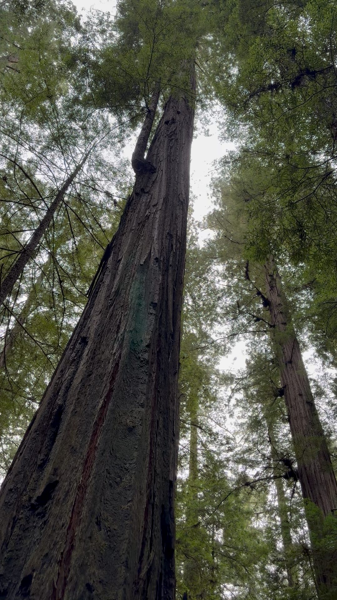
I went to see the redwoods and if you haven’t been there, you must go. Breath in their magnificence —the air around them is so fresh. In the redwoods, my harvest weary sinuses cleared and my jumbled mind unraveled. These trees don’t live near a major city—the coast of California with the coastal redwoods is punctuated with small towns and harbors. A feeling of peace and majesty descends on you there along with the fog. The trees have an intimate relationship with the fog. It provides up to 30% of their water.

A group of trees in the forest

AI-generated content may be incorrect.

Big Tree is a favorite stop and one of the trees that helped promote awareness of the need to save the redwoods from logging. By the time people began working to protect the coastal redwoods 100 years ago, 95% of them had been cut down.

A group of people standing in front of a large tree

AI-generated content may be incorrect.
A book on a wood surface

AI-generated content may be incorrect.
A close-up of a sign

AI-generated content may be incorrect.

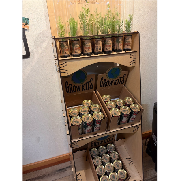
There are three varieties of redwoods. The coastal redwoods are the tall ones, the giant sequoia have fatter trunks, and the dawn redwood, found in China, is a smaller version of these glorious trees. Various ranger stations and tourist traps sell seeds and baby trees. I wasn’t confident I could bring a coastal redwood back to Iowa and keep it happy, so I opted for a dawn redwood seed.

Humbolt Redwoods State Park features the Avenue of the Giants Auto Tour just off of Highway 101 and contains trees up to 2000 years old that have never been logged. These trees have stood up to fires, insects, and floods. We traversed the Northern most part of it and took time to visit some of the picturesque small towns along Highway 101as well.

One tourist trap, Trees of Mystery, has a notable collection of native pottery and information about the tribes that once inhabited the redwoods and this continent.

The area also has casinos and gas stations owned by the local tribes. It wasn’t until the 1960s that the redwood forests became state and national parks and the tribes were able to recover land ownership.

Saving the trees took an immense amount of effort by all sorts of people—some standing in front of logging equipment and taking companies to court, others buying up the forests and donating them back to the state. Women’s groups in California were at the forefront of the effort early in the 1900s, but people have been working to save the trees, including the founders of the GAP, even into this century.

A person standing in front of a sign in a forest

AI-generated content may be incorrect.
A plaque on a rock

AI-generated content may be incorrect.
A tall tree in the forest

AI-generated content may be incorrect.

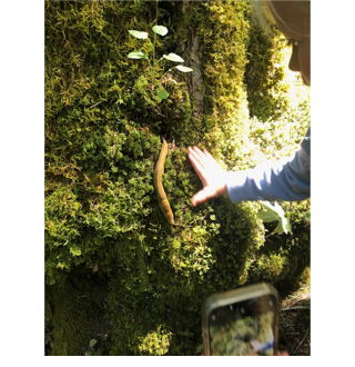
These huge trees grow burls when injured and stressed. You can see how red the wood is when looking at this burl. The tree litter is known as duff or sorrel.

A close-up of a tree trunk

AI-generated content may be incorrect.

As shown below, the roots of the coastal redwoods are fairly shallow. Over the centuries, the trees sustain some damage and still they persist.

Redwoods have shallow, intertwined roots and although they produce seeds, sprouts from burls are the major way they reproduce.

A large tree stump in the woods

AI-generated content may be incorrect.
A large tree with moss growing on it

AI-generated content may be incorrect.

Above, sprouts pour from a burl.

A group of plants and trees

AI-generated content may be incorrect.

Take a look at some of the cross sections and see the passage of time.

A piece of paper on a tree stump

AI-generated content may be incorrect.

Thanks to the collective will of the people of California and elsewhere, these trees persist and reproduce. But it takes constant vigilance, and appreciation of them.

A tree stump with a small plant growing out of it

AI-generated content may be incorrect.

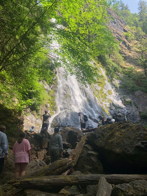
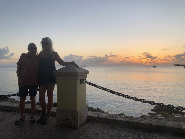
We have relatives from Portland who came with us and guided us on the trip. We drove along Oregon’s beautiful coast, staying in the small town of Bandon. Sadly, we had to walk out of a diner there because Fox News was on tv but we found a great seafood place and had a lovely seaside view.

A view of a parking lot from a balcony

AI-generated content may be incorrect.

We stopped at a light house/Coast Guard facility, had more seafood at Newport (home of Rogue Brewery) and even though it was early in the season, we saw some whales at a distance.

A bowl of soup with shrimp and spices on a table

AI-generated content may be incorrect.
A white lighthouse with a truck parked in front of it

AI-generated content may be incorrect.
A fence with a wooden post and a body of water

AI-generated content may be incorrect.

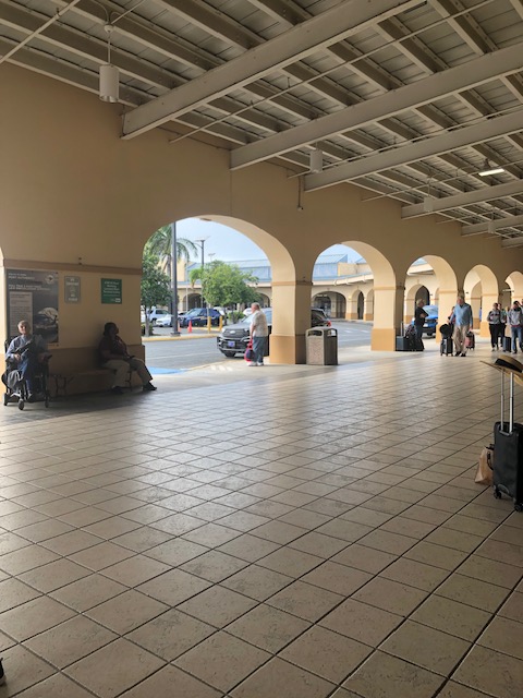
We flew in and out of Portland. Portland has a beautiful airport (see photo below) and is not a war zone. (Although possibly someone is trying to make it so. On the return trip, the air national guard was flying obnoxiously.) It’s horrible to have whole cities, and even states, lied about and subjected to unwanted occupation. Fortunately, people in this country know how to work together to save the trees and even democracy.

Dune Days of Summer

I spent my childhood in the Great Lakes dunes, climbing them and watching the dune creatures including numerous spiders and ant lions. Mostly what I remember is the joy (and challenge) of climbing and the feeling of being isolated, except for the company of my best pal, Kathi, who shared my love of nature and curiosity.

My son inherited the dune joy and when he and his family proposed a trip to Western Michigan including my hometown of Holland (and beloved relatives) and Sleeping Bear Dunes, I jumped at the chance.

For those unfamiliar, the dune ecosystem is characterized by shifting mounds of sand. It was formed by glaciers and can be parabolic or perched.

The Holland area features the parabolic dunes which extend all the way to the shore and provide beautiful beaches.

.

People on a beach

AI-generated content may be incorrect.

We did more hiking in the Sleeping Bear Dunes, perched dunes with some rigorous and beautiful hikes.

A wooden path on a hill with a body of water in the background

AI-generated content may be incorrect.

Skies were hazy. Thanks Climate Change fires.

Some trails are easier than others and well stabilized. This is a National Park after all.

A person standing next to a sign

AI-generated content may be incorrect.

The dunes range from 200 to 450 feet tall (on the Dune Climb shown in the next photos. Don’t go down if you can’t climb up. Sand isn’t easy to climb on because it isn’t stable. If you need a rescue, the rate is rumored to be $3,000. Here I am below (front), displaying my dune climbing skills.

We made it back after taking a less easy path.

A group of people walking through a forest

AI-generated content may be incorrect.

The most challenging hike was the “double dunes” or as it is officially called, Dune Climb. Not all of us participated but for those who did, the two plus hour walk rewarded them with an otherworldly view and a fun run to the bottom.

A couple of kids running down a sand hill

AI-generated content may be incorrect.

After a day of duneing, stop by Cherry Republic, for a large assortment of cherry products, ice cream and sit down casual dining.

A person walking in a garden

AI-generated content may be incorrect.

And don’t forget the pie!

A box of pastries on a table

AI-generated content may be incorrect.

Currently the dunes are protected by “The Sand Dune Protection and Management Act of 1976 designated these as sand dune areas, and the Act was amended in 1989 to designate 74,000 acres (29,600 ha) as Critical Dune Areas, which were characterized as “a unique, irreplaceable, and fragile resource.”

Only 25% of the Great Lakes dunes are in public, protected hands and the way things are going, we might lose access to them forever.

Washington Does it All

No, I don’t mean Washington DC, I recently took a trip to the Pacific Northwest to hang out with family in Washington State. I was greeted by a view of Mt. Rainier, an active, but beautiful, volcano.

A view of a mountain range from an airplane

AI-generated content may be incorrect.

There’s plenty to do in the Pacific Northwest and we stuck close to where we were staying on Hood Canal. If you haven’t been to the area, it’s filled with hiking trails and for a Midwesterner, otherworldly sights.

A group of tall trees

AI-generated content may be incorrect.

We travel with kids, and this was a kid friendly, casual adventure—no passport or make-up required. As a bonus, we encountered few mosquitos.

We stocked up at Costco and a seafood market,

A plate of seafood and watermelon

AI-generated content may be incorrect.

My dreams of a new life owning a family oyster farm were dashed when I actually had an oyster slider (not shown above. )The water is cool enough that Vibrio was unlikely (more of a Florida thing) but I won’t be doing it again.

We started our hiking at Guillemot Cove. The kids were delighted by the stump house and all the baby crabs on the shore. It’s the dry season right now but we managed to see a few banana slugs.

This area had lots of toxic but pretty foxglove.

A group of purple flowers on a plant

AI-generated content may be incorrect.

The next day we traveled to Ranger Hole Trail and saw a glacial waterfall. Some of us took a cold plunge. I did not.

.

From there we traveled to Mount Walker to look across Hood Canal, a western lobe of Puget Sound, and view the eastern Olympic mountains and Mt. Rainier. It was a narrow, bumpy road to the top. My DIL captured this brave classic car ascending.

A car on a road with trees

AI-generated content may be incorrect.

We celebrated the 4th of July in a very US way, with fireworks and unexpectedly viewing a protest. One child didn’t know why ICE would be dangerous.

And let’s be honest, why would we achieve independence from a mad king with divine rights, only to let flies die around our cheese?

A group of kids looking at fireworks

AI-generated content may be incorrect.

The following day, we hiked a small portion of the vast Olympic National Park, viewing Lake Cushman and hiking at Staircase for yet another cold plunge and a climb on a downed Western Cedar.

(The following week, this area was closed due to fire.)

We ended our trip by taking a commuter ferry (from Bremerton) to Seattle for sightseeing and shopping. One of the kids thought the ferry ride was the best part.

A person looking out a window

AI-generated content may be incorrect.

Here are a few other details, should you wish to avoid the weak dollar and just stay in the country for an upcoming vacation to Washington. We used the All Trails app to find our hiking spots and our trails were designated as easy. That doesn’t mean they were flat or rock free. We flew into SeaTac and rented a car. The nearest big town was Silverdale. Washington has no income tax but other taxes, including gas taxes, make up for it. I’m not a fan of this tax structure but look at all this beauty ready to be publicly accessed!

Sadly, I returned to Iowa to find out the state was abandoning one of the last shreds of public lands. Outdoorsy folks here have to leave to get satisfaction. I bet every Iowan knows someone who is going to Canada, Michigan, the Smokies, or the West Coast this summer. Meanwhile, I’m back in Iowa itching my new mosquito bites and cursing the stressful corn sweat. Once again, the kids are turning to their screens. Hopefully, Iowa will get new leadership, and our state will stop taking things from the public to reward the private.

Hurricanes and Oyster farms

I spent the holidays on a journey of 5,000. First, we drove with our dog to Charlotte NC to see family. We drove so we could take our dog and she could be with the pet sitter and her cousin dogs and cat while we humans flew to our holiday destination. By the way, she was very naughty and ate out of the litter box when we were gone. 

I would say something about this grin but it would be cliché.

Then we flew with family to Seattle and drove a little further onto Kitsap Peninsula. It was beautiful and shrouded in mist, giving way to sun on occasion.

This is through-a-window photo of an Oyster farm for sale. If you’re looking to get away from it all and are up for some demanding work, this might be your opportunity. If I was young and disgruntled with the corporate world, this might be for me. It’s even clean by farming standards.

We visited a little seaside tourist town, much like Pella with a Viking theme and Norwegian heritage.

We even had iconic Chinese food Christmas Day.

We returned to Charlotte for more time together. At last weather and upcoming school forced our hand and it was time to leave. 

You might ask why we drive. I wonder this myself when I’m on the highway. My parents and my in-laws were from the Road Trip Generation of the 1950s and my family is from Michigan. My uncle even worked for the auto industry as an accountant. My husband’s family took a cross-country trip, starting in San Diego. We grew up on car trips. And our dog loves a car trip and is an excellent traveler. The anxiety about a road trip come from planning the route due to weather issues. Weather is becoming more extreme, and I know people who have given up road trips entirely after encountering fires, flood, and tornados on a single trip!

On the way back, we traveled through the area damaged by Hurricane Helene. (map here)

I-40 through the Blue Ridge Mountain region was washed away by Helene. It was being repaired and the repair collapsed, so travelers must resort to various detours. GPS suggested some detours but once we got close to the site, the North Carolina Highway department had huge signs suggesting other paths and fortunately, we went with the highway department. Trucks took a much longer detour (complete with bad weather on the day we left) and cars had a road with one lane open in each direction. (here’s a map for those interested)

All along the route, starting in Asheville, we saw trees lying flat after being pushed down the mountain. Quite a lot of the damage has clearly been cleaned up. We were guided by signs with signs telling truckers not to take the car route. Here are some photos of trucks crashed along the by-pass in the area known as The Rattler. Highway Patrol were staked out along the way to keep trucks off and for good reason. The one lane road was no passing all the way but somewhat peaceful despite twists and flurries. DOT workers even directed traffic at one turn along the way, which was good because that area had no cell service and the GPS went down. Below is a photo of the town of Hot Springs, population 520 About 40% of the surrounding area had no cell serviceeven before the hurricane. The hurricane knocked out most cell service in the area. You can see where the people in this region would not get information about a pending flood. 

I don’t want a government dictatorship but on this part of the trip, the government and government workers were extremely helpful and reliable. GPS uses AI for the directions and our car-only shortcut wasn’t among the routes mapped out by AI. When I read this article about UPS shutting down some rural drop off areas, I got to thinking about how rural areas are underserved populations. They don’t have enough profit in them, and they truly need equality and inclusion, yet vote against it. 

Cell service relies on private carriers. When my kids lived in Detroit, US Cellular service was terrible and even charged me for being in Canada when I wasn’t. In Kitsap County Washington, also fairly rural, my Verizon carrier was so slow I thought my phone was broken. Yet here we are in the US voting for the politicians who want to privatize services and cut government. I can’t see this working out well for the rural areas. Think about applying this patchwork of services to the entire country. As a nation, we’ve already tossed out Net Neutralityso our carriers can do whatever they want to us. Who knows what lies ahead for rural areas. They might become less and less desirable places to live, as before the rural electrification act.

Below, traveling on the detour, Hot Springs in the snow.

For now, I’m home safely before the impending snowstorm, having a cup of coffee, watching the world go by, and wishing those on the road safe travels. 

Views from an Island

Last week, I had the delightful pleasure of visiting St. Croix in the US Virgin Islands, one of the US Territories.

Just east of Puerto Rico, the US bought these islands from Denmark in 1917.

Above: Flying in

The US Virgin Islands is a US territory. US citizens don’t need a passport. They don’t go through customs. Dollars are the currency. The only weird thing about it is that cars are driven on the left side of the road. And, the people can’t vote. They have a representative to Congress but she can’t vote either. 

It’s been described as a sleepy place to go for snorkeling, diving, and beach life. We visited the town Frederiksted, off the beaten path. How “sleepy” is it? Well, what could be more peaceful than a beautiful ocean view with a chicken? 

Besides being mellow, this town had great sunsets. It’s a little over 1000 miles from the equator, which makes it immune to seasonal daylight fluctuations. Sunset was always about 6:30 pm. The temperature was in the 80s during the day and in the 70s at night, with a soft, balmy trade wind.

*

And best of all—great friends live here!

Two women standing next to a pole

Description automatically generated

Beaches were sandy or rocky depending on the location. Some were great for beach combing, although you aren’t supposed to take your findings off the islands. 

The coral reef ecosystem meant abundant animal and plant life. Here (above) is a brain coral skeleton on the beach. Brain coral make up the foundation of coral reefs and can live up to 900 years!

One of the first thing we did was go snorkeling. I was pretty bad at it—something to improve for sure—but I did see peaceful turtles, beautiful fish, and colorful corals as I thrashed around and adjusted my snorkel.

The sun goes down before seven and of course, people want to be out and about. Bright lights keep turtles from nesting and disorient hatchlings. Turtles mate in the water and lay eggs on land—preferably in the dark of night. Baby turtles need to crawl towards the ocean and they find it by moon and starlight on water

During turtle nesting season, streetlights are red to keep the females happy and the hatchlings from being fooled into crawling towards the road.

We enjoyed great Caribbean food, local beer  (excellent), and even a shot of rum at this place shown below. 

*

We weren’t able to see the entire island during our too short trip but we managed to visit a former sugar plantation and its not so nice dungeon. The only bright side to this is a successful slave rebellion and emancipation in 1848. 

As mentioned before, the citizens can’t vote and have little representation, but they are US residents. Hurricanes in 2017 damaged several buildings and funds to repair them  are just coming in now. 

A black truck parked on a street corner

Description automatically generated

I wasn’t on the “shopping” side of the island (Christiansted) but I did manage to grab a few souvenirs. I’ll have to return!

Thank you to Kathi Lee for these * photos.